Why Boating Signs Are Essential for Safe Navigation
Boating signs are the “traffic signals” of our waterways, guiding operators safely, warning of hazards, and providing vital information to prevent collisions. Much like road signs for drivers, these navigational aids are essential for boaters to avoid accidents and steer with confidence.
Key Types of Boating Signs:
- Lateral Markers – Red and green buoys marking channel boundaries (follow “Red, Right, Returning” rule)
- Regulatory Signs – White markers with orange symbols indicating rules, restrictions, and prohibited areas
- Informational Markers – Provide directions, distances, and general guidance
- Special Purpose Buoys – Yellow markers for anchorages, military zones, and cable areas
- Safe Water Marks – Red and white striped markers indicating safe passage areas
Research shows that collisions are the number one type of accident on the water, making a proper understanding of these aids critical for every boater.
The U.S. Coast Guard maintains the comprehensive U.S. Aids to Navigation System (ATONS), which uses standardized colors, shapes, numbers, and light characteristics to convey specific meanings. Boaters must also recognize regulatory markers, diving flags, and distress signals.
I’m Cole Reilly. With nearly two decades of experience creating custom yacht signs for over 10,000 marine projects, I’ve seen how proper boating signs improve both safety and vessel identity. My expertise covers everything from navigation requirements to crafting high-quality signage that withstands harsh marine environments.
, regulatory signs (white with orange symbols for danger, restrictions, and information), special purpose markers (yellow buoys for anchorages and hazards), and vessel identification requirements - boating signs infographic")
Related content about boating signs:
The U.S. Aids to Navigation System (ATONS)
The U.S. Aids to Navigation System (ATONS) is the “street sign” system for our waterways. Maintained by the U.S. Coast Guard on federal waters, with other bodies managing inland areas, these boating signs help you determine your position, plot a safe course, and avoid hidden dangers.
The two main types of aids are buoys (floating markers) and guides or dayboards (fixed structures). Both can be lighted for night navigation or have sound signals for poor visibility. Their effectiveness comes from a standardized system of colors, shapes, numbering, and light characteristics.

For a detailed reference, we recommend the A Handy Guide from the United States Coast Guard.
Lateral Markers: Defining the Channel
Lateral markers are the lane lines for channels, creating a corridor of safe passage. Their meaning depends on your direction of travel—whether you’re “returning from sea” or “proceeding upstream.”
- Can buoys are green, cylindrical, and have odd numbers (1, 3, 5). When returning, keep them on your port (left) side. Their numbers increase as you head inland. Lighted versions show a green or white single-flash light.
- Nun buoys are red, cone-shaped, and have even numbers (2, 4, 6). When returning, keep them on your starboard (right) side. Their numbers also increase as you head inland. Lighted versions typically show a red or white double-flash light.
Fixed dayboards serve the same purpose, following identical color and numbering rules. They are often made with retroreflective materials to be visible at night.
The ‘Red, Right, Returning’ Rule Explained
The most critical mnemonic in U.S. navigation is: “Red, Right, Returning.”
“Returning” means traveling from open sea toward inland waters or heading upstream. When doing so, you must keep the red, even-numbered boating signs on your right (starboard) side. Consequently, the green, odd-numbered markers will be on your left (port) side.

When heading out to sea or downstream, the rule is reversed: keep green markers to your right and red markers to your left. This simple, consistent system applies to both buoys and dayboards, ensuring safe navigation for all.
Non-Lateral Markers: Information Beyond the Channel
Many boating signs provide information about hazards, safe areas, and special zones outside of marked channels.
- Safe Water Marks: Red and white vertically striped, they indicate navigable water all around. They mark channel centerlines or offshore approach points and may have a white light flashing a Morse Code “A”.
- Isolated Danger Marks: Black with red horizontal bands, these mark specific hazards like rocks or wrecks. They are topped with two black spheres and, if lighted, show a white light with two quick flashes.
- Special Purpose Buoys: Solid yellow markers indicate anchorages, military zones, pipeline crossings, or dredging operations. If lighted, they show a yellow light.
- Mooring Buoys: These white buoys with a blue horizontal band are the only buoys you can legally tie up to. Tying to any other navigation aid is illegal and dangerous.
- State Waters Obstruction Marks: Black and white vertically striped buoys warn of obstructions. Do not pass between the buoy and the nearest shore.
Understanding these specialized markers is just as important as knowing your basic channel system. For more detailed information about safe water markers and other navigation aids, check out this helpful resource: Learn about safe water markers.
Understanding Regulatory and Informational Boating Signs
Beyond navigation, boating signs also act as the “traffic cops” of the waterways. These regulatory and informational markers control boat traffic, communicate local rules, and provide essential guidance. Their standardized design of consistent colors and shapes creates a universal language for boaters.

Decoding Colors and Shapes on Boating Signs
Orange and white markers signify a regulatory or informational sign, making them distinct from red and green navigation buoys.
- Diamond Shape: Signals danger, such as rocks, shoals, or dams. Proceed with caution.
- Circle Shape: Indicates a controlled area or restriction, such as a speed limit (“Slow – No Wake,” “5 MPH”). “Slow-no-wake” means the slowest speed possible while maintaining steering.
- Square Shape: Provides helpful information and directions, like pointing to marinas, fuel docks, or landmarks.
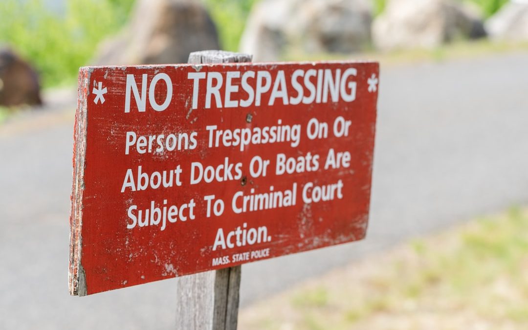
- Diamond with a Cross: Means “Keep Out.” These signs mark prohibited areas like swimming zones or dams. Ignoring them is dangerous and can lead to fines.
Other Important Boating Signs and Signals
- Dive Flags: The red flag with a white diagonal stripe (SCUBA flag) or the blue and white Alpha flag indicates divers are in the water. You must stay at least 100 feet away.
- Distress Signals: An orange flag with a black square over a black circle is a visual distress signal. Boaters are legally and morally obligated to render assistance if it is safe to do so.
- Naval Vessel Protection Zones: You must stay at least 100 yards from any U.S. naval vessel and operate at minimum speed within 500 yards. Violations are a felony with severe penalties.
Understanding these signs is critical, as collisions remain the leading cause of boating accidents. For more details, you can explore more on boating restriction signs.
Global and Regional Navigation Systems
As you travel, you’ll find that boating signs are not universal. The International Association of Lighthouse Authorities (IALA) has established two main global systems to bring order to this complexity. You can learn more at the International Association of Lighthouse Authorities (IALA).
IALA Buoyage System
The world is divided into two navigation regions, and knowing which one you’re in is critical.
- IALA Region B covers the Americas, Japan, the Philippines, and South Korea. This is where our familiar “Red, Right, Returning” rule applies. Red buoys are kept to starboard when returning from sea.
- IALA Region A covers most of the rest of the world, including Europe, Africa, and Australia. In Region A, the colors are reversed: the rule is “Green, Right, Returning.” Green buoys mark the starboard side when returning from sea. Misinterpreting this difference can lead to dangerous situations.
Western Rivers Marking System
On America’s inland waterways, like the Mississippi River system, you’ll find a different system. Instead of consecutive numbers, river markers often display mileage numbers indicating the distance from the river’s mouth. The “Red, Right, Returning” rule is less reliable here, and fixed daymarks are more common than floating buoys due to changing water levels and currents.
Intracoastal Waterway (ICW)
The 3,000-mile Intracoastal Waterway (ICW) along the Atlantic and Gulf coasts uses the IALA Region B system but adds its own layer of yellow symbols that take precedence.
- Yellow triangles are kept on your starboard (right) side when traveling clockwise (south on the Atlantic, west on the Gulf).
- Yellow squares are kept on your port (left) side.
A red buoy with a yellow square must be treated as a port-side marker when following the ICW, as the yellow symbol overrides the buoy’s color.
| Feature | IALA Region A (Most of World) | IALA Region B (Americas, Japan, etc.) |
|---|---|---|
| Port Side | Red (Buoy color) | Green (Buoy color) |
| Starboard Side | Green (Buoy color) | Red (Buoy color) |
| “Returning” | “Green, Right, Returning” (Green buoys to your right) | “Red, Right, Returning” (Red buoys to your right) |
| Numbers | Odd numbers on port, even numbers on starboard | Odd numbers on port, even numbers on starboard |
| Preferred Channel | Top band indicates preferred channel (e.g., red over green means preferred channel is to the right) | Top band indicates preferred channel (e.g., green over red means preferred channel is to the right) |
Understanding these different systems isn’t just about following rules – it’s about adapting to the wisdom of local waters and ensuring safe passage wherever your trips take you.
From Theory to Practice: Using Charts and Custom Signage
Putting your knowledge of boating signs to work involves blending traditional navigation with modern technology.
Nautical Charts and Electronic Chartplotters
Nautical charts are the “road maps” of the water, showing depths, shorelines, and the locations of navigation aids. Always use current charts and check for Notices to Mariners before any trip.
Electronic chartplotters display digital charts and your vessel’s real-time position, making navigation more precise. However, electronics can fail. Always carry paper charts as a backup and never let technology replace your ability to read physical boating signs and understand the Navigation Rules.
The Importance of High-Quality, Durable Vessel Signage
Beyond public aids, your vessel’s own signage is crucial for safety and identity. Your boat’s name, hailing port, and safety instructions must be clear and durable.
At YachtSigns, we create custom, high-quality signage that meets regulatory requirements while enhancing your vessel’s beauty. We combine time-honored craftsmanship with modern fabrication technology, engineering our signs to withstand the harsh marine environment.
For a deeper dive, explore Your Comprehensive Guide to Yacht Signs.
The Art of Vessel Identification
Proper vessel identification is an art form that expresses personal pride.
- Vessel name and hailing port requirements: For U.S. Coast Guard documented vessels, the name and hailing port must be permanently attached to the exterior hull. The documentation number (preceded by “NO.”) must be displayed on an interior structural part in block numbers at least 3 inches tall.
- Aesthetics and material durability: Saltwater and UV radiation demand superior materials. We specialize in crafting required signage with precision and aesthetic appeal, often using marine-grade 316L stainless steel for its corrosion resistance. Our products are engineered to endure extreme conditions, keeping your vessel’s identity vibrant for years.
When you’re ready to merge function with style, we’re here to help: Custom LED Signs for Yachts.
Frequently Asked Questions about Waterway Markers
Here are answers to common questions we receive about boating signs and waterway markers.
What is the most important rule for navigating a marked channel?
The golden rule in U.S. waters is “Red, Right, Returning.” Keep red lateral markers on your right (starboard) side when heading from open sea toward inland waters or traveling upstream. When heading out to sea, reverse it: keep red markers on your left. This simple rule helps you stay safely within marked channel boundaries.
What should I do if I see a damaged, unlit, or missing buoy?
A damaged or missing navigation aid is a safety hazard. Report it to the U.S. Coast Guard immediately via VHF-FM Channel 16 for urgent issues or by phone for non-emergencies. Provide a specific location and describe the problem (e.g., missing, unlit, tilted). Some states, like Florida (866-405-BUOY), have dedicated hotlines. Prompt reporting helps authorities fix the problem and protects other boaters.
Are the signs on a lake the same as those in coastal waters?
It depends. Boating signs on federal waters (coastal channels, Great Lakes) follow the standard U.S. Aids to Navigation System. However, many inland lakes and rivers are under state jurisdiction and may have their own marking systems. While efforts were made to standardize these, variations can still exist. Always check local charts and state boating guides before exploring new waters. Never assume—research the specific rules for the body of water you plan to steer.
Conclusion: The Importance of Clear Communication on the Water
From the red and green buoys of a channel to the orange and white warnings of regulatory markers, boating signs are the essential language of our waterways. Mastering this language, especially the “Red, Right, Returning” rule, is the foundation of responsible boating. A deep understanding of these visual cues is your best defense against preventable accidents like collisions or running aground, empowering you to steer with confidence.
This commitment to clear communication extends to your own vessel. Your boat’s name, hailing port, and safety markings are vital for identification and reflect your pride of ownership.
At YachtSigns, we believe in the power of clear, high-quality communication. Our passion is combining traditional craftsmanship with modern fabrication technology to create signage that is not only beautiful but also durable and legible against sun, salt, and spray. We engineer pieces designed to last and lift your vessel’s identity.
We invite you to explore custom yacht signs for your vessel and find the difference that premium quality and thoughtful design can make.